Author: Courtney Fisher

  • The Indiana City That Was Supposed to Rival Chicago—Then Vanished

    The Indiana City That Was Supposed to Rival Chicago—Then Vanished

    The Indiana City That Was Supposed to Rival Chicago—Then Vanished

    A Dream Buried Beneath the Dunes

    Standing along the southern shore of Lake Michigan today, it’s almost impossible to imagine that this peaceful stretch of sand was once expected to become one of the greatest cities in the Midwest. Nearly 190 years ago, investors believed this quiet shoreline could become one of the busiest cities in the region—even a rival to Chicago.

    Long before the Indiana Dunes drew hikers, beachgoers, and nature lovers, investors saw promise in this land. They imagined a busy city with businesses, homes, docks, and ships carrying goods across the Great Lakes. Some even believed it could compete with the young city of Chicago.

    Surveyors mapped out streets and divided the land into lots. Promises of success attracted investors hoping to make their fortunes. For a while, it looked like Indiana was on the verge of creating its next great city.

    But that future never arrived, and the dream quickly faded.

    Instead of becoming a busy lakeside city, City West disappeared almost as quickly as it began. Financial problems, bad luck, and strong competition turned one of Indiana’s biggest dreams into one of its most forgotten stories.

    Today, thousands of people visit the Indiana Dunes each year, unaware they’re close to the site of a city that was supposed to change Indiana’s history. Only a few records, old maps, and historians’ research remain to tell the story of a place that almost became something special.

    How can a whole city disappear before it even begins? To answer that, we have to look back at Indiana in the 1830s, a time filled with hope, rapid growth, and big dreams.

    If you’re fascinated by Indiana’s hidden history, be sure to check out my articles on Billie Creek Village: The Indiana Time Capsule Hiding in Plain Sight and The Indiana Roads That Seem to Go Nowhere. Both explore remarkable places that many Hoosiers have never heard of, yet each has played a unique role in Indiana’s past.

    The Big Dream: Building Indiana’s Next Great City

    To understand why City West was created, you have to picture Indiana in the mid-1830s. The state was growing rapidly, and people believed the future belonged to those who invested in new land and transportation. Canals were being dug, roads were expanding, and towns seemed to appear almost overnight.

    In 1836, investors set their sights on a stretch of land along the southern shore of Lake Michigan in what is now Porter County. They believed they had found the perfect location for a thriving city. With direct access to the Great Lakes, they imagined ships arriving daily with passengers and cargo, while merchants, businesses, and families poured in to build new lives.

    The investors called their ambitious project City West. Their goal was to build a major commercial port capable of competing with the fast-growing city of Chicago, which was still a young settlement. While Chicago showed promise, no one knew which city would ultimately lead the Midwest. Many investors thought City West had just as much chance to succeed.

    Surveyors planned streets, divided the land into lots, and advertised the town to buyers. Newspapers and ads promised prosperity and encouraged people to invest before prices rose. Like many projects back then, this dream was fueled by hope and the belief that northwest Indiana was about to grow quickly.

    For a while, that hope felt real. More people became interested, land changed hands, and it seemed like construction would soon turn the quiet shore into a busy town. Few people expected that, in just a few years, the dream of City West would start to fall apart.

    Investors believed this shoreline could become one of the Midwest’s busiest cities.

    Did You Know?

    One of the most surprising things about City West is that it wasn’t just an idea discussed around a table—it was a real town on paper. Surveyors carefully mapped streets, divided land into lots, and created official town plats to market the development to potential buyers. Investors purchased property believing they were buying into the next great city on Lake Michigan.

    Today, those historic maps still exist, offering a fascinating glimpse into a city that was planned in remarkable detail but never fully came to life. They serve as a reminder that sometimes history’s biggest dreams leave behind little more than ink on paper.

    The Indiana Land Boom: A Time of Big Dreams

    During the 1830s, Indiana was one of the fastest-growing states in the country. New families moved west in search of affordable land, new opportunities, and a chance to build better lives. Small settlements quickly turned into towns, and many believed Indiana was about to become an economic powerhouse.

    State leaders were just as hopeful. In 1836, Indiana enacted the Internal Improvements Act, investing millions of dollars in canals, roads, and railroads. The goal was clear: connect communities, make travel easier, and boost trade across the state. Many thought these changes would turn Indiana into a center of commerce for the growing nation.

    This wave of optimism led to a rush to buy land. Investors bought thousands of acres, convinced that today’s quiet fields would soon become busy towns. All over Indiana, new communities were planned, streets were mapped, and lots were sold, sometimes before any buildings were even built.

    City West was created during this exciting time. Its spot along Lake Michigan seemed nearly perfect. Supporters thought the city could become a major shipping port, drawing merchants, manufacturers, and settlers from all over the country. If trade kept growing as expected, City West might have become one of Indiana’s most important cities.

    But there was a problem. Most of this hope was based on guesses, not facts. Many investors were betting on what they hoped would happen, not what was already there. As long as money kept coming in, the dream survived. But if the economy slowed or investors lost confidence, projects like City West would be the first to struggle.

    Unfortunately for City West, that moment came much sooner than anyone expected, and the collapse happened before the project could really begin.

    The Financial Crash That Changed Everything

    Just as City West seemed ready to become one of Indiana’s next big success stories, disaster hit with the Panic of 1837.

    In the spring of 1837, the United States faced a major financial crisis known as the Panic of 1837. Banks failed, businesses closed, and thousands of Americans lost their savings almost overnight. It became nearly impossible to get credit, land values fell, and the excitement that had fueled so many projects quickly disappeared.

    City West was one of the many communities caught in the collapse. The investors suddenly ran out of money to keep building. People who had bought land couldn’t afford to develop it or gave up on their plans. The city they imagined remained mostly an idea, and without money, construction stopped.

    As time passed, hope faded. Families and business owners who might have moved to City West chose other places, with many picking nearby Chicago. Both cities started with big plans, but Chicago was better able to survive hard times. It had better transportation, more people, and steady investment, which helped it recover when the economy improved.

    City West wasn’t as lucky, and its momentum quickly disappeared.

    Instead of becoming the busy lakeside city its founders wanted, the streets remained mostly empty. The planned buildings were never built, and the dream of a great Indiana port slowly faded.

    In just a few years, one of Indiana’s boldest projects became one of its biggest forgotten failures. What was once seen as the future of northwest Indiana was quietly reclaimed by time and nature, leaving behind only old maps, records, and a lasting “what if?” that still interests people today.

    What If City West Had Succeeded?

    It’s one of the most fascinating questions in Indiana history: What if City West had survived?

    When City West was founded in 1836, Chicago was still a young and growing town. Although it showed tremendous promise, no one could have predicted that it would eventually become one of the largest and most influential cities in the United States. At the time, many investors believed City West had just as much potential.

    City West’s location along the southern shore of Lake Michigan gave it access to one of North America’s busiest waterways. If enough settlers, businesses, and investment had arrived before the Panic of 1837, it could have developed into a major shipping and trading center. A thriving port might have attracted warehouses, factories, railroads, and thousands of new residents to northwest Indiana.

    But history took a different path.

    Chicago continued to grow thanks to its expanding transportation network, strategic location, and steady flow of people and businesses. It became the economic powerhouse of the Midwest, while City West faded into obscurity before it could prove itself.

    Most historians agree that the Panic of 1837 played a major role in City West’s failure. However, they also point out that Chicago enjoyed several long-term advantages, including a larger population, stronger commercial development, and continued investment. Even if the financial crisis had never happened, there is no guarantee that City West would have overtaken its northern neighbor.

    Still, it’s impossible not to wonder.

    What would northwest Indiana look like today if City West had flourished? Would a major metropolis have risen along Indiana’s shoreline? Would businesses and immigrants have chosen Indiana instead of Illinois? Could the state’s economy—and perhaps even its identity—have developed in a completely different way?

    We’ll never know the answers. But those unanswered questions are exactly what make City West such a captivating story. It reminds us that history isn’t shaped only by the places that succeeded—it’s also shaped by the ambitious dreams that never had the chance to become reality.

    What Remains of City West Today?

    Little Evidence Remains

    If you’re hoping to find abandoned buildings or crumbling streets, you might be disappointed, because City West left behind very few visible signs. Over time, nature slowly reclaimed the land. Wind shifted the sand dunes, plants spread, and the shoreline changed, until the dream of a busy city faded beneath the natural beauty of northwest Indiana.

    Today, the place where City West was planned is part of Indiana Dunes National Park and Indiana Dunes State Park. Thousands of people hike, relax on the beaches, and explore the dunes every year, often without realizing they’re near the site of one of Indiana’s biggest unrealized dreams.

    A Story Preserved Through History

    Even though the buildings were never built, the story of City West isn’t completely lost. Historians have saved old maps, land records, newspaper ads, and government documents that show how ambitious the project was. These records help us piece together a city that mostly existed only on paper.

    Since so little remains above ground, City West is now an archaeological mystery. Researchers continue to study old documents to find out where streets, lots, and early buildings were planned. Every map and record gives us another glimpse of a future that never happened.

    Why City West Still Matters

    Maybe that’s what makes City West so interesting. It isn’t remembered for big buildings or famous landmarks, but for its possibilities—a city that carried the hopes of its time before fading away. Even though there’s little left to see, its story reminds us how quickly things can change and how even the biggest dreams can disappear.

    Even though City West never became the thriving city its founders imagined, its brief history is full of surprising details that make it one of Indiana’s most intriguing forgotten places.

    Fascinating Facts About City West

    Although City West disappeared before it could become the thriving city its founders imagined, its short history is filled with remarkable details. From ambitious plans and bold investments to a financial collapse that changed everything, these fascinating facts reveal why City West remains one of Indiana’s most intriguing forgotten places.

    1. It Was Founded During Indiana’s Biggest Building Boom

    City West was established in 1836, when Indiana was investing heavily in canals, roads, and other transportation projects. Across the state, optimism was high, and many believed new towns would drive economic growth and attract thousands of new residents.

    2. It Was Designed to Be a Major Great Lakes Port

    City West wasn’t planned as a small village. Its founders envisioned a bustling commercial city with docks, warehouses, businesses, and homes serving as a gateway for trade on Lake Michigan.

    3. The Panic of 1837 Changed Everything

    The nationwide financial crisis devastated land speculation across the United States. Investors lost money, construction projects stopped, and City West’s ambitious plans came to an abrupt end before the town could truly take shape.

    4. Chicago Was Still Finding Its Footing

    When City West was founded, Chicago was still a young settlement. At the time, many people believed northwest Indiana had just as much potential to become the region’s dominant city.

    5. Nature Reclaimed the Landscape

    Because so little development occurred, the dunes, forests, and shoreline gradually reclaimed the area. Today, it’s difficult to imagine that surveyors once mapped streets where visitors now hike, relax, and enjoy the beaches.

    6. Most Hoosiers Have Never Heard of It

    Despite being one of Indiana’s most ambitious development projects of the 1830s, City West is rarely mentioned in history books or classrooms. Its story survives through historical maps, newspaper accounts, land records, and the work of dedicated historians.

    7. It Remains One of Indiana’s Greatest “What If?” Stories

    City West may not have left behind towering buildings or famous landmarks, but it left behind something just as powerful—a question. What if the economy hadn’t crashed? What if investors had stayed? What if Indiana, instead of Illinois, had become home to the Midwest’s greatest lakeside city? Those unanswered questions continue to make City West one of the state’s most fascinating forgotten stories.

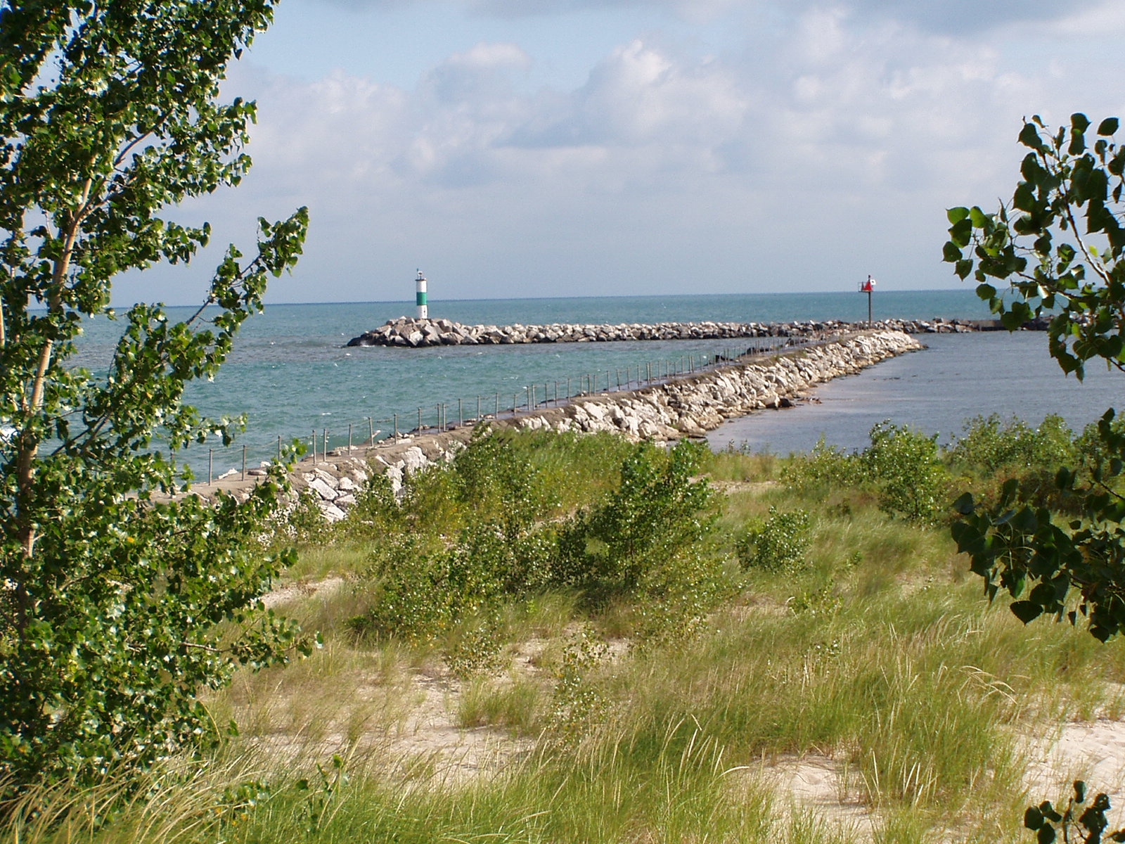
    As the sun sets over Lake Michigan, it’s difficult to imagine that this peaceful shoreline was once expected to become one of the Midwest’s greatest cities. Today, only history remembers the dream of City West.

    A Dream That Time Forgot

    History often celebrates the cities that succeeded, but the stories of places that almost changed everything can be just as fascinating.

    City West was more than just a failed real estate project; it was a symbol of the hope that spread across Indiana in the 1830s. Its founders believed they were building the future, laying out streets and selling lots, confident their lakeside town would become a busy center of trade and opportunity. For a short time, it really seemed possible.

    Then, almost as soon as the dream began, it ended. A financial crisis, changing fortunes, and the rapid growth of nearby Chicago turned City West from a place of great promise into one of Indiana’s most forgotten stories.

    Today, the beaches and dunes have replaced the bustling city its founders once imagined. Visitors come to enjoy the area’s natural beauty, often unaware that beneath the sand is the story of a community that never had the chance to grow.

    Maybe that’s why City West is so unforgettable. It reminds us that history is shaped not just by success, but also by ambition, risk, and dreams that never came true. Sometimes the biggest mysteries aren’t in abandoned buildings or ghost stories. Sometimes they’re in the places history almost remembered.

    The story of City West is just one of many forgotten chapters in Indiana’s history. From abandoned communities and historic villages to mysterious landmarks and overlooked events, our state is filled with incredible stories waiting to be rediscovered. If you enjoyed this article, be sure to explore more posts here on Mysteries of Indiana and uncover another hidden piece of Hoosier history.

    What do you think?

    Have you ever heard of City West before? Do you think it could have rivaled Chicago if the Panic of 1837 hadn’t happened? I’d love to know your thoughts! If you know about another forgotten Indiana town or hidden piece of Hoosier history, share it in the comments below.

    If you enjoyed uncovering the forgotten story of City West, consider sharing this article with another Indiana history lover. Every share helps keep these forgotten stories alive.
  • Billie Creek Village

    Billie Creek Village


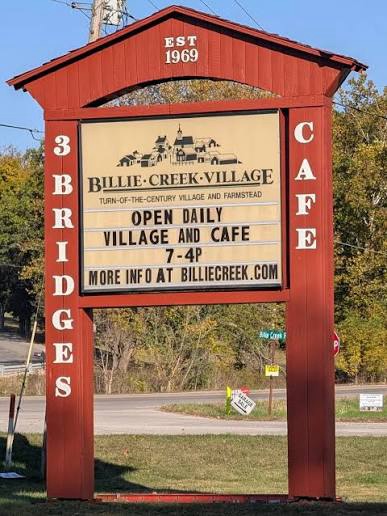
    Welcome to Billie Creek Village, where Indiana’s past comes to life.

    A Step Back Into Indiana’s Past

    Have you ever visited a place that made you feel like you’d traveled back in time?

    The kind of place where every old building has a story, every creaky floorboard makes you wonder who walked there before you, and everything just feels… different.

    That’s exactly how I felt when I learned about Billie Creek Village.

    Tucked away just outside Rockville, Indiana, Billie Creek Village is one of those places that many people have never heard of—but once you visit, it’s hard to forget. It’s peaceful, full of history, and reminds us of what life in Indiana looked like long before smartphones, highways, and busy schedules.

    A Place Built to Keep History Alive

    Back in the late 1960s, a group of local people realized that pieces of Indiana’s history were slowly disappearing. Old buildings were being torn down, family stories were fading away, and important parts of the past were being lost.

    Instead of letting that happen, they decided to save what they could.

    That’s how Billie Creek Village came to life.

    When it opened in 1969, it wasn’t meant to be just another museum. The goal was to create a place where people could actually experience history instead of simply reading about it in a textbook.

    I think that’s what makes this place so special.


    Historic buildings throughout the village have been carefully preserved to tell the story of early Indiana life.

    Walking Through the Village

    As you wander through the village, it’s easy to let your imagination take over.

    You can picture children laughing as they walked to the one-room schoolhouse.

    You can imagine families gathering for Sunday service at the old church.

    You almost expect to hear the sound of horses pulling wagons down the road or see smoke drifting from a cabin chimney.

    The buildings aren’t just old—they each tell part of Indiana’s story.

    One of my favorites is the Beeson-DePlanty Cabin, which dates back to the 1830s. Standing inside makes you appreciate just how tough Indiana’s early settlers had to be. Life wasn’t easy, but they built homes, raised families, and helped shape the communities we know today.

    Another beautiful building is St. Joseph’s Catholic Church, built in 1886. It isn’t hard to imagine weddings, baptisms, and Sunday mornings bringing neighbors together inside those walls.


    St. Joseph’s Catholic Church has welcomed generations of worshippers and remains one of the village’s most beautiful buildings.

    Then there’s the one-room schoolhouse, where children of all ages learned together under one roof. It’s a reminder of how much education—and life in general—has changed over the years.


    Imagine attending school in a single classroom with students of every age learning together.

    The Covered Bridges

    If you’ve spent much time exploring Indiana, you probably know that Parke County is famous for its covered bridges.

    Billie Creek Village is home to three of them, and each one has its own story.


    Covered bridges like this one have become iconic symbols of Parke County’s rich history.

    The Billie Creek Covered Bridge, built in 1895.

    The Leatherwood Station Covered Bridge from 1899.

    And the Beeson Covered Bridge, built in 1906.

    Walking through one of these bridges makes you stop for a moment.

    How many people crossed here over a hundred years ago?

    Where were they going?

    What conversations echoed between these wooden walls?

    Sometimes it’s fun to let your imagination fill in the blanks.

    A Village That Almost Disappeared

    Like many historic places, Billie Creek Village has faced some difficult times.

    After years of welcoming visitors, the village eventually closed, and in 2012 its future looked uncertain when the property went up for auction.

    For a while, it seemed like Indiana might lose another important piece of its history.

    Thankfully, people who cared about the village stepped in.

    Over the last few years, volunteers and community members have worked hard to bring Billie Creek Village back to life. Thanks to those efforts, visitors can once again explore this incredible place and experience a small piece of Indiana’s past.

    Why Places Like This Matter

    I think places like Billie Creek Village remind us that history isn’t just something we read about.

    It happened right here.

    Real people lived in these homes, crossed these bridges, went to school, got married, celebrated milestones, and built communities that helped shape Indiana into what it is today.

    Whether you visit because you love history, enjoy photography, or simply like discovering places that aren’t overrun with tourists, Billie Creek Village is worth the trip.

    And who knows?

    Maybe you’ll leave with a few questions of your own.

    After all, every old building has stories we’ll probably never know.


    As the sun sets over Billie Creek Village, it’s easy to imagine the stories these historic buildings still hold.

    Have You Been There?

    Have you ever visited Billie Creek Village?

    If you have, I’d love to hear about your experience. Did you have a favorite building? Did one of the covered bridges catch your attention? Or did the village leave you wondering about the people who once called it home?

    Leave a comment below and share your story. You never know—it might inspire someone else to visit this hidden Indiana treasure.

  • The Indiana Roads That Seem to Go Nowhere

    The Indiana Roads That Seem to Go Nowhere


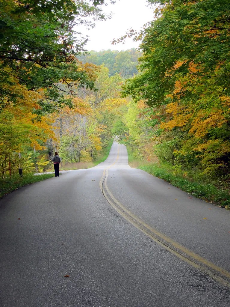
    Many of Indiana’s back roads follow routes that have connected communities for generations.

    Where the Journey Begins

    Have you ever driven down a quiet Indiana back road and wondered where it leads?

    The farther you drive, the quieter everything becomes. Traffic fades away, the pavement narrows, and towering trees begin to close in around you. Before long, it feels like you’ve left the modern world behind.

    At first glance, these roads seem forgotten. They appear to lead nowhere and may not seem important in today’s fast-paced world.

    But there’s much more to them than meets the eye.

    Many of Indiana’s quiet country roads were once vital lifelines that connected bustling river towns, family farms, railroad depots, mills, schools, and businesses that helped shape the Hoosier State. Long before interstate highways stretched across Indiana, these roads carried stagecoaches, horse-drawn wagons, early automobiles, and generations of Hoosiers traveling to work, church, markets, and home.

    As new highways were built and travel changed, many of these once-busy routes were bypassed. Some now end near abandoned bridges, forgotten communities, or places slowly being reclaimed by nature. Others still serve local residents but no longer see the constant flow of travelers they once did.

    Today, these roads offer something different.

    They invite us to slow down, enjoy the scenery, and imagine the lives of the people who traveled them decades—or even centuries—ago. Every curve, old bridge, and weathered crossroads has a story waiting to be discovered.

    Join me as we explore some of Indiana’s most fascinating roads. They may seem to lead nowhere, but each one has an incredible story to tell.

    🛣️ Road Trip Tip

    Indiana has more than 95,000 miles of public roads, many of which follow routes first established by Native American trails, pioneer paths, and early wagon roads. Sometimes the most interesting journey begins when you leave the interstate behind.

    1. Old Michigan Road — The Highway That Helped Build Indiana


    Michigan Road, established in the 1830s, became one of Indiana’s first major highways, connecting Madison on the Ohio River to Michigan City on Lake Michigan.

    Today, Old Michigan Road looks like just another quiet country road winding through Indiana. In some places, you can drive for miles without seeing much more than a few houses, open farmland, or stretches of forest.

    It may seem ordinary now, but nearly 200 years ago, this was one of the most important roads in the state.

    Construction of Michigan Road began in the 1830s after the federal government granted Indiana land to build a highway connecting the Ohio River at Madison with Michigan City on the southern shore of Lake Michigan. At the time, Indiana was still a young state, and reliable roads were essential for connecting communities and encouraging growth.

    Stretching more than 250 miles, Michigan Road linked southern, central, and northern Indiana. It gave settlers, merchants, and travelers a dependable route across the state, helping new towns develop and local businesses thrive along the way.

    Imagine traveling this road in the 1830s.

    Instead of paved roads and passing cars, you would have encountered horse-drawn wagons, stagecoaches, and people traveling on foot. Dust filled the air during dry weather, while heavy rains often turned sections of the road into thick mud. Travelers stopped at inns and taverns to rest for the night, blacksmiths repaired broken wagon wheels, and small communities depended on the steady flow of people passing through.

    For many Hoosiers, Michigan Road was much more than a road—it was a lifeline.

    As railroads expanded and, later, modern highways took over, Michigan Road gradually lost its role as Indiana’s primary transportation route. Some sections were widened or absorbed into newer highways, while others remained almost unchanged, quietly preserving a piece of the state’s early history.

    Today, if you know where to look, you can still follow much of the original route. Historic markers, preserved stretches of roadway, and towns that owe their growth to Michigan Road continue to tell the story of a highway that helped shape Indiana.

    Driving these roads today, it’s easy to overlook their importance. Yet every mile carries the footsteps of pioneers, the wheels of stagecoaches, and the dreams of the families who helped build the Hoosier State.

    Sometimes, the quietest roads tell the greatest stories.

    🕰️ History Snapshot

    Construction of Michigan Road began in 1832 and eventually stretched more than 250 miles from Madison on the Ohio River to Michigan City on Lake Michigan. It became one of Indiana’s first major north-south highways and helped shape the growth of countless communities.

    2. Historic National Road (US 40) — The Highway That Connected a Nation


    Historic US 40, also known as the National Road, helped connect Indiana to the growing nation and transformed travel across the Midwest.

    Long before Interstate 70 carried thousands of drivers across Indiana every day, there was the National Road.

    Often called America’s Main Street, the National Road was the nation’s first federally funded highway, connecting communities and opening new opportunities for travel, trade, and settlement. When it reached Indiana in the early 1800s, it transformed the state almost overnight.

    As the road stretched westward, new towns sprang up along its path. Hotels, restaurants, blacksmith shops, general stores, and wagon repair businesses welcomed the steady stream of travelers moving through the Hoosier State.

    Imagine standing along the road nearly 200 years ago.

    Instead of the hum of modern traffic, you would have heard the clatter of wagon wheels, the sound of horses’ hooves striking the dirt, and stagecoaches carrying passengers eager to reach the next town before nightfall. Every stop along the route offered travelers a chance to rest, exchange stories, and prepare for the next leg of their journey.

    For many communities, the National Road wasn’t just a road—it was their livelihood.

    As automobiles became more common in the early 1900s, the National Road adapted once again. Gas stations, roadside diners, motor courts, and family-owned businesses appeared along the highway, serving generations of travelers exploring America by car.

    But everything changed in the 1960s and 1970s.

    With the construction of Interstate 70, long-distance traffic was diverted away from many of the small towns that had depended on the National Road for decades. Businesses that had once been filled with customers saw fewer visitors, and some eventually closed their doors for good.

    Today, driving sections of Historic US 40 feels like taking a step back in time. You’ll still find beautifully preserved brick buildings, historic courthouses, vintage signs, and family-owned businesses that have welcomed travelers for generations.

    Although it no longer carries the traffic it once did, the National Road remains one of Indiana’s greatest historic treasures. Every mile tells the story of westward expansion, hardworking communities, and the people who helped build both Indiana and the nation.

    Sometimes, the roads that seem quieter today were once among the busiest places in America.

    👀 Keep an Eye Out

    As you travel Historic US 40, look for old gas stations, vintage motels, brick storefronts, and historic bridges. Many have stood along highways for decades, offering a glimpse of what road travel looked like before the interstate era.

    3. Tunnelton Road — The Road That Leads Into Indiana’s Railroad Past


    Tunnelton Road leads through the hills of southern Indiana to one of the state’s most remarkable pieces of railroad history—the historic Tunnelton Tunnel.

    Some Indiana roads don’t just take you from one place to another—they take you back in time.

    Tucked away among the rolling hills of Lawrence County, Tunnelton Road winds through peaceful forests, quiet farmland, and rugged limestone country. At first glance, it may seem like just another scenic back road, but hidden nearby is one of Indiana’s most fascinating pieces of railroad history: the historic Tunnelton Tunnel.

    Built in the 1850s for the Ohio & Mississippi Railroad, the Tunnelton Tunnel was an incredible engineering achievement for its time. Workers spent years blasting through solid limestone using hand tools, black powder, and sheer determination. When it opened, the tunnel became a vital link that helped move passengers, mail, and freight across southern Indiana.

    Imagine standing here more than 150 years ago.

    The ground would have trembled as steam locomotives emerged from the darkness, their whistles echoing through the hills. Smoke drifted above the trees, and trains carried everything from coal and timber to families traveling in search of new opportunities.

    For nearby communities, the railroad meant jobs, commerce, and a connection to the rest of the country.

    As the decades passed, however, rail travel changed. Larger trains and modern engineering led to the construction of a newer tunnel nearby, leaving the original Tunnelton Tunnel behind. The once-busy route grew quiet, and nature slowly reclaimed the surrounding landscape.

    Today, driving Tunnelton Road feels like stepping into another era. The winding road, towering trees, and peaceful countryside make it easy to forget how much activity once filled this valley.

    The area has also inspired countless local legends and ghost stories over the years. While those tales remain part of Indiana folklore, the tunnel’s documented history is remarkable enough on its own.

    Whether you’re interested in history, photography, or simply discovering places that most travelers overlook, Tunnelton Road offers a glimpse into a chapter of Indiana’s past that still echoes through the hills.

    Sometimes, the roads that seem to disappear into the woods are leading you straight into history.

    📍 If You Visit

    The original Tunnelton Tunnel is not maintained as a public tourist attraction. Parts of the area may be on private property or present safety hazards, including uneven ground and unstable conditions. Always respect posted signs, stay on public roads, and admire the site from safe, legal access points.

    4. The Old River Roads Along the Ohio River — Where Indiana’s Earliest Communities Began


    For generations, quiet roads along the Ohio River connected farms, river towns, and busy steamboat landings that helped shape southern Indiana.

    Some of Indiana’s most beautiful roads don’t lead to busy cities or major attractions.

    Instead, they wind through quiet river towns, rolling hills, and peaceful countryside where it almost feels like time has stood still.

    Long before interstate highways crossed Indiana, the Ohio River was one of the state’s most important transportation routes. Flatboats, steamboats, and ferries carried people, livestock, and goods from town to town, while the narrow roads along the river connected homes, farms, mills, and local businesses to busy river landings.

    For many families, these roads were part of everyday life.

    Farmers hauled crops to nearby docks. Merchants delivered supplies to local stores. Children traveled to one-room schools, and neighbors gathered for church services, county fairs, and community celebrations.

    Imagine driving these roads in the mid-1800s.

    Instead of passing only a few cars, you might have met a wagon loaded with barrels of corn, a stagecoach carrying passengers, or workers heading toward a bustling river landing. The sounds of steamboat whistles echoed across the water, reminding everyone that another shipment—or another visitor—had arrived.

    As railroads expanded and highways offered faster routes across the state, many of these river roads fell into disuse. Some towns continued to thrive, while others gradually shrank as businesses moved away and river traffic declined.

    Today, these roads offer something you won’t find on an interstate.

    They offer peace.

    Driving along the Ohio River, you’ll pass historic homes, old churches, weathered barns, and small communities that still hold onto their rich history. Around nearly every bend is a reminder that these roads once connected people to opportunities, livelihoods, and each other.

    Although they may seem to lead nowhere today, they actually lead straight into the story of Indiana’s earliest settlements.

    Sometimes, the best way to understand Indiana’s past is to leave the highway behind and follow the river instead.

    🚤 History Snapshot

    Before railroads and interstate highways transformed travel, the Ohio River was one of Indiana’s busiest transportation corridors. The roads that followed its banks connected communities to ferries, mills, warehouses, and river ports that helped build the Hoosier State.

    5. Old State Road 450 — A Scenic Drive Through Indiana’s Hidden Hills


    State Road 450 winds through the scenic hills of southern Indiana, offering travelers a glimpse of landscapes that have changed very little over the decades.

    If you’re looking for a road that truly feels like it leads into another world, Old State Road 450 in southern Indiana is hard to beat.

    Winding through the hills of Martin and Lawrence counties, this quiet highway passes dense forests, limestone bluffs, rolling farmland, and small communities where life moves at a slower pace. It’s the kind of road that encourages you to roll down the windows, take your time, and enjoy the journey.

    While State Road 450 still serves local residents today, parts of the route feel far removed from the busy highways that carry most travelers across Indiana. In many places, you can drive for miles without seeing much more than wildlife, old farmhouses, and breathtaking views of the countryside.

    But these quiet roads weren’t always so isolated.

    For generations, roads like this connected families living in rural southern Indiana. Farmers used them to transport livestock and crops to nearby towns; children rode them to school; and neighbors depended on them long before modern highways made travel faster and easier.

    Imagine driving here a century ago.

    Instead of paved shoulders and passing traffic, you’d likely encounter horse-drawn wagons, cattle being moved between farms, or a Model T making its way along the winding road. Every trip required patience, and every journey was part of daily life in rural Indiana.

    Today, the road offers something that has become increasingly rare—a chance to slow down.

    The hills, forests, and quiet landscapes remind us that not every destination has to be famous to be meaningful. Sometimes the road itself is the reason to explore.

    Driving Old State Road 450 isn’t about reaching the fastest route or checking off a tourist attraction. It’s about experiencing a side of Indiana that has changed very little over the years.

    Some of the state’s greatest treasures aren’t found at the end of the road—they’re found along the way.

    🌄 Scenic Stop

    If you’re exploring southern Indiana, take time to stop at local overlooks, small-town diners, and historic landmarks along the route. The scenery changes with every season, making this drive especially beautiful during the fall when the hills are covered in colorful autumn leaves.

    6. Old Vincennes Trace — Following Indiana’s Earliest Footsteps


    Long before paved roads existed, the Vincennes Trace guided Native Americans, pioneers, and early settlers across Indiana.

    Long before Indiana had paved roads or even stagecoach routes, there was the Vincennes Trace.

    Unlike the highways we know today, the Trace began as a network of trails used by Native American tribes for generations. These paths crossed forests, rivers, and open prairies, connecting villages and important trading areas long before Indiana became a state.

    As European settlers arrived, they followed many of these same trails. Over time, the paths widened into rough wagon roads, becoming some of the earliest transportation routes in Indiana.

    Traveling the Vincennes Trace was far from easy.

    Heavy rains turned the trail into thick mud, rivers could become impassable, and dense forests made every journey unpredictable. Yet thousands of people relied on these trails as they searched for new homes, traded goods, or traveled between settlements.

    Imagine walking this route more than 200 years ago.

    There were no road signs, no bridges, and certainly no GPS. Travelers depended on their knowledge of the land, the guidance of others, and a determination to keep moving forward despite the challenges.

    Although much of the original Vincennes Trace has disappeared beneath modern roads and development, parts of its route can still be traced today. Historic markers and preserved sections remind visitors that some of Indiana’s oldest roads began as simple footpaths through the wilderness.

    It’s incredible to think that roads many people travel every day may follow paths first walked centuries ago.

    Sometimes, the oldest roads aren’t paved at all—they’re the ones history has quietly hidden beneath our feet.

    🏕️ History Snapshot

    The Vincennes Trace predates Indiana’s statehood and helped shape many of the transportation routes that followed. It remains one of the oldest known travel corridors in the Hoosier State.

    7. The Road to Hindostan Falls — A Drive Into One of Indiana’s Forgotten Stories


    The peaceful roads leading to Hindostan Falls pass through an area once home to one of Indiana’s earliest frontier settlements.

    There are roads in Indiana that don’t just lead to a destination—they lead to a story.

    The quiet roads leading to Hindostan Falls in Martin County are a perfect example.

    Today, they’re peaceful country roads surrounded by farmland, forests, and the gentle flow of the East Fork White River. It’s difficult to imagine that this quiet landscape was once home to one of Indiana’s earliest frontier settlements.

    In the early 1800s, the nearby town of Hindostan was filled with hope. Families built homes, businesses opened, and settlers believed they were creating a thriving community that would continue to grow for generations.

    But life on the frontier was unpredictable.

    Repeated outbreaks of malaria, flooding, and changing transportation routes eventually forced many residents to leave. What had once been a promising settlement slowly faded into history, leaving behind only scattered reminders of the people who lived there.

    Driving these roads today, there’s a peacefulness that’s hard to describe.

    The rolling hills, winding roads, and quiet countryside make it easy to forget the hardships endured by those early settlers. Yet knowing the history changes the experience. Every curve in the road feels like another step into Indiana’s past.

    The drive itself becomes part of the journey.

    Rather than rushing to a destination, you’re traveling through a landscape that witnessed the hopes, struggles, and determination of Indiana’s earliest pioneers.

    Sometimes, the road isn’t simply taking you somewhere.

    Sometimes it takes you back in time.

    🌾 If You Visit

    While exploring the Hindostan Falls area, take time to enjoy the natural beauty of the White River and the surrounding countryside. Historic markers and local museums can provide additional insight into the area’s fascinating frontier history. As always, respect private property and leave historic sites exactly as you found them.

    🗺️ Explore Responsibly

    The places featured on Mysteries in Indiana are part of our state’s rich history. If you decide to visit, always respect private property, follow posted signs, leave no trace, and help preserve these locations for future generations. Some sites may have limited access or safety hazards, so plan ahead and explore responsibly.

  • Welcome to Mysteries of Indiana

    Welcome to Mysteries of Indiana

    Have you ever driven past an old building, a quiet cemetery, or a forgotten road and wondered, “What happened here?”

    That curiosity is what inspired Mysteries in Indiana.

    Indiana is full of hidden stories. Behind the historic buildings, small towns, old roads, and forgotten places are stories that deserve to be remembered. Some are spooky, some are mysterious, and some are simply fascinating pieces of the past that many people never get to hear about.

    I created this blog because I love discovering the history and legends that make Indiana unique. My goal is to explore the Hoosier State one story at a time — uncovering haunted locations, strange events, local legends, and the history behind the places we pass every day.

    Here you’ll find stories about:

    🕯 Haunted places and ghostly encounters
    🏛 Indiana’s forgotten history
    🔎 Unsolved mysteries and strange happenings
    🌲 Local legends passed down through generations
    🚗 Interesting places to explore across the state

    Not every mystery has an answer, and not every legend can be proven — but every story has something that makes it worth sharing.

    I hope Mysteries in Indiana becomes a place where people can come to learn, explore, and see our state in a whole new way. Whether you’re a lifelong Hoosier, a history lover, or someone who just enjoys a good mystery, I’m glad you’re here.

    So grab a cup of coffee, get comfortable, and come explore Indiana’s hidden stories with me.

    Welcome to Mysteries in Indiana — where every town has a story, every place has a past, and every mystery is waiting to be uncovered.

    — Courtney