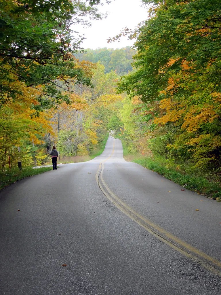

Many of Indiana’s back roads follow routes that have connected communities for generations.
Where the Journey Begins
Have you ever driven down a quiet Indiana back road and wondered where it leads?
The farther you drive, the quieter everything becomes. Traffic fades away, the pavement narrows, and towering trees begin to close in around you. Before long, it feels like you’ve left the modern world behind.
At first glance, these roads seem forgotten. They appear to lead nowhere and may not seem important in today’s fast-paced world.
But there’s much more to them than meets the eye.
Many of Indiana’s quiet country roads were once vital lifelines that connected bustling river towns, family farms, railroad depots, mills, schools, and businesses that helped shape the Hoosier State. Long before interstate highways stretched across Indiana, these roads carried stagecoaches, horse-drawn wagons, early automobiles, and generations of Hoosiers traveling to work, church, markets, and home.
As new highways were built and travel changed, many of these once-busy routes were bypassed. Some now end near abandoned bridges, forgotten communities, or places slowly being reclaimed by nature. Others still serve local residents but no longer see the constant flow of travelers they once did.
Today, these roads offer something different.
They invite us to slow down, enjoy the scenery, and imagine the lives of the people who traveled them decades—or even centuries—ago. Every curve, old bridge, and weathered crossroads has a story waiting to be discovered.
Join me as we explore some of Indiana’s most fascinating roads. They may seem to lead nowhere, but each one has an incredible story to tell.
🛣️ Road Trip Tip
Indiana has more than 95,000 miles of public roads, many of which follow routes first established by Native American trails, pioneer paths, and early wagon roads. Sometimes the most interesting journey begins when you leave the interstate behind.
1. Old Michigan Road — The Highway That Helped Build Indiana

Michigan Road, established in the 1830s, became one of Indiana’s first major highways, connecting Madison on the Ohio River to Michigan City on Lake Michigan.
Today, Old Michigan Road looks like just another quiet country road winding through Indiana. In some places, you can drive for miles without seeing much more than a few houses, open farmland, or stretches of forest.
It may seem ordinary now, but nearly 200 years ago, this was one of the most important roads in the state.
Construction of Michigan Road began in the 1830s after the federal government granted Indiana land to build a highway connecting the Ohio River at Madison with Michigan City on the southern shore of Lake Michigan. At the time, Indiana was still a young state, and reliable roads were essential for connecting communities and encouraging growth.
Stretching more than 250 miles, Michigan Road linked southern, central, and northern Indiana. It gave settlers, merchants, and travelers a dependable route across the state, helping new towns develop and local businesses thrive along the way.
Imagine traveling this road in the 1830s.
Instead of paved roads and passing cars, you would have encountered horse-drawn wagons, stagecoaches, and people traveling on foot. Dust filled the air during dry weather, while heavy rains often turned sections of the road into thick mud. Travelers stopped at inns and taverns to rest for the night, blacksmiths repaired broken wagon wheels, and small communities depended on the steady flow of people passing through.
For many Hoosiers, Michigan Road was much more than a road—it was a lifeline.
As railroads expanded and, later, modern highways took over, Michigan Road gradually lost its role as Indiana’s primary transportation route. Some sections were widened or absorbed into newer highways, while others remained almost unchanged, quietly preserving a piece of the state’s early history.
Today, if you know where to look, you can still follow much of the original route. Historic markers, preserved stretches of roadway, and towns that owe their growth to Michigan Road continue to tell the story of a highway that helped shape Indiana.
Driving these roads today, it’s easy to overlook their importance. Yet every mile carries the footsteps of pioneers, the wheels of stagecoaches, and the dreams of the families who helped build the Hoosier State.
Sometimes, the quietest roads tell the greatest stories.
🕰️ History Snapshot
Construction of Michigan Road began in 1832 and eventually stretched more than 250 miles from Madison on the Ohio River to Michigan City on Lake Michigan. It became one of Indiana’s first major north-south highways and helped shape the growth of countless communities.
2. Historic National Road (US 40) — The Highway That Connected a Nation

Historic US 40, also known as the National Road, helped connect Indiana to the growing nation and transformed travel across the Midwest.
Long before Interstate 70 carried thousands of drivers across Indiana every day, there was the National Road.
Often called America’s Main Street, the National Road was the nation’s first federally funded highway, connecting communities and opening new opportunities for travel, trade, and settlement. When it reached Indiana in the early 1800s, it transformed the state almost overnight.
As the road stretched westward, new towns sprang up along its path. Hotels, restaurants, blacksmith shops, general stores, and wagon repair businesses welcomed the steady stream of travelers moving through the Hoosier State.
Imagine standing along the road nearly 200 years ago.
Instead of the hum of modern traffic, you would have heard the clatter of wagon wheels, the sound of horses’ hooves striking the dirt, and stagecoaches carrying passengers eager to reach the next town before nightfall. Every stop along the route offered travelers a chance to rest, exchange stories, and prepare for the next leg of their journey.
For many communities, the National Road wasn’t just a road—it was their livelihood.
As automobiles became more common in the early 1900s, the National Road adapted once again. Gas stations, roadside diners, motor courts, and family-owned businesses appeared along the highway, serving generations of travelers exploring America by car.
But everything changed in the 1960s and 1970s.
With the construction of Interstate 70, long-distance traffic was diverted away from many of the small towns that had depended on the National Road for decades. Businesses that had once been filled with customers saw fewer visitors, and some eventually closed their doors for good.
Today, driving sections of Historic US 40 feels like taking a step back in time. You’ll still find beautifully preserved brick buildings, historic courthouses, vintage signs, and family-owned businesses that have welcomed travelers for generations.
Although it no longer carries the traffic it once did, the National Road remains one of Indiana’s greatest historic treasures. Every mile tells the story of westward expansion, hardworking communities, and the people who helped build both Indiana and the nation.
Sometimes, the roads that seem quieter today were once among the busiest places in America.
👀 Keep an Eye Out
As you travel Historic US 40, look for old gas stations, vintage motels, brick storefronts, and historic bridges. Many have stood along highways for decades, offering a glimpse of what road travel looked like before the interstate era.
3. Tunnelton Road — The Road That Leads Into Indiana’s Railroad Past

Tunnelton Road leads through the hills of southern Indiana to one of the state’s most remarkable pieces of railroad history—the historic Tunnelton Tunnel.
Some Indiana roads don’t just take you from one place to another—they take you back in time.
Tucked away among the rolling hills of Lawrence County, Tunnelton Road winds through peaceful forests, quiet farmland, and rugged limestone country. At first glance, it may seem like just another scenic back road, but hidden nearby is one of Indiana’s most fascinating pieces of railroad history: the historic Tunnelton Tunnel.
Built in the 1850s for the Ohio & Mississippi Railroad, the Tunnelton Tunnel was an incredible engineering achievement for its time. Workers spent years blasting through solid limestone using hand tools, black powder, and sheer determination. When it opened, the tunnel became a vital link that helped move passengers, mail, and freight across southern Indiana.
Imagine standing here more than 150 years ago.
The ground would have trembled as steam locomotives emerged from the darkness, their whistles echoing through the hills. Smoke drifted above the trees, and trains carried everything from coal and timber to families traveling in search of new opportunities.
For nearby communities, the railroad meant jobs, commerce, and a connection to the rest of the country.
As the decades passed, however, rail travel changed. Larger trains and modern engineering led to the construction of a newer tunnel nearby, leaving the original Tunnelton Tunnel behind. The once-busy route grew quiet, and nature slowly reclaimed the surrounding landscape.
Today, driving Tunnelton Road feels like stepping into another era. The winding road, towering trees, and peaceful countryside make it easy to forget how much activity once filled this valley.
The area has also inspired countless local legends and ghost stories over the years. While those tales remain part of Indiana folklore, the tunnel’s documented history is remarkable enough on its own.
Whether you’re interested in history, photography, or simply discovering places that most travelers overlook, Tunnelton Road offers a glimpse into a chapter of Indiana’s past that still echoes through the hills.
Sometimes, the roads that seem to disappear into the woods are leading you straight into history.
📍 If You Visit
The original Tunnelton Tunnel is not maintained as a public tourist attraction. Parts of the area may be on private property or present safety hazards, including uneven ground and unstable conditions. Always respect posted signs, stay on public roads, and admire the site from safe, legal access points.
4. The Old River Roads Along the Ohio River — Where Indiana’s Earliest Communities Began

For generations, quiet roads along the Ohio River connected farms, river towns, and busy steamboat landings that helped shape southern Indiana.
Some of Indiana’s most beautiful roads don’t lead to busy cities or major attractions.
Instead, they wind through quiet river towns, rolling hills, and peaceful countryside where it almost feels like time has stood still.
Long before interstate highways crossed Indiana, the Ohio River was one of the state’s most important transportation routes. Flatboats, steamboats, and ferries carried people, livestock, and goods from town to town, while the narrow roads along the river connected homes, farms, mills, and local businesses to busy river landings.
For many families, these roads were part of everyday life.
Farmers hauled crops to nearby docks. Merchants delivered supplies to local stores. Children traveled to one-room schools, and neighbors gathered for church services, county fairs, and community celebrations.
Imagine driving these roads in the mid-1800s.
Instead of passing only a few cars, you might have met a wagon loaded with barrels of corn, a stagecoach carrying passengers, or workers heading toward a bustling river landing. The sounds of steamboat whistles echoed across the water, reminding everyone that another shipment—or another visitor—had arrived.
As railroads expanded and highways offered faster routes across the state, many of these river roads fell into disuse. Some towns continued to thrive, while others gradually shrank as businesses moved away and river traffic declined.
Today, these roads offer something you won’t find on an interstate.
They offer peace.
Driving along the Ohio River, you’ll pass historic homes, old churches, weathered barns, and small communities that still hold onto their rich history. Around nearly every bend is a reminder that these roads once connected people to opportunities, livelihoods, and each other.
Although they may seem to lead nowhere today, they actually lead straight into the story of Indiana’s earliest settlements.
Sometimes, the best way to understand Indiana’s past is to leave the highway behind and follow the river instead.
🚤 History Snapshot
Before railroads and interstate highways transformed travel, the Ohio River was one of Indiana’s busiest transportation corridors. The roads that followed its banks connected communities to ferries, mills, warehouses, and river ports that helped build the Hoosier State.
5. Old State Road 450 — A Scenic Drive Through Indiana’s Hidden Hills

State Road 450 winds through the scenic hills of southern Indiana, offering travelers a glimpse of landscapes that have changed very little over the decades.
If you’re looking for a road that truly feels like it leads into another world, Old State Road 450 in southern Indiana is hard to beat.
Winding through the hills of Martin and Lawrence counties, this quiet highway passes dense forests, limestone bluffs, rolling farmland, and small communities where life moves at a slower pace. It’s the kind of road that encourages you to roll down the windows, take your time, and enjoy the journey.
While State Road 450 still serves local residents today, parts of the route feel far removed from the busy highways that carry most travelers across Indiana. In many places, you can drive for miles without seeing much more than wildlife, old farmhouses, and breathtaking views of the countryside.
But these quiet roads weren’t always so isolated.
For generations, roads like this connected families living in rural southern Indiana. Farmers used them to transport livestock and crops to nearby towns; children rode them to school; and neighbors depended on them long before modern highways made travel faster and easier.
Imagine driving here a century ago.
Instead of paved shoulders and passing traffic, you’d likely encounter horse-drawn wagons, cattle being moved between farms, or a Model T making its way along the winding road. Every trip required patience, and every journey was part of daily life in rural Indiana.
Today, the road offers something that has become increasingly rare—a chance to slow down.
The hills, forests, and quiet landscapes remind us that not every destination has to be famous to be meaningful. Sometimes the road itself is the reason to explore.
Driving Old State Road 450 isn’t about reaching the fastest route or checking off a tourist attraction. It’s about experiencing a side of Indiana that has changed very little over the years.
Some of the state’s greatest treasures aren’t found at the end of the road—they’re found along the way.
🌄 Scenic Stop
If you’re exploring southern Indiana, take time to stop at local overlooks, small-town diners, and historic landmarks along the route. The scenery changes with every season, making this drive especially beautiful during the fall when the hills are covered in colorful autumn leaves.
6. Old Vincennes Trace — Following Indiana’s Earliest Footsteps

Long before paved roads existed, the Vincennes Trace guided Native Americans, pioneers, and early settlers across Indiana.
Long before Indiana had paved roads or even stagecoach routes, there was the Vincennes Trace.
Unlike the highways we know today, the Trace began as a network of trails used by Native American tribes for generations. These paths crossed forests, rivers, and open prairies, connecting villages and important trading areas long before Indiana became a state.
As European settlers arrived, they followed many of these same trails. Over time, the paths widened into rough wagon roads, becoming some of the earliest transportation routes in Indiana.
Traveling the Vincennes Trace was far from easy.
Heavy rains turned the trail into thick mud, rivers could become impassable, and dense forests made every journey unpredictable. Yet thousands of people relied on these trails as they searched for new homes, traded goods, or traveled between settlements.
Imagine walking this route more than 200 years ago.
There were no road signs, no bridges, and certainly no GPS. Travelers depended on their knowledge of the land, the guidance of others, and a determination to keep moving forward despite the challenges.
Although much of the original Vincennes Trace has disappeared beneath modern roads and development, parts of its route can still be traced today. Historic markers and preserved sections remind visitors that some of Indiana’s oldest roads began as simple footpaths through the wilderness.
It’s incredible to think that roads many people travel every day may follow paths first walked centuries ago.
Sometimes, the oldest roads aren’t paved at all—they’re the ones history has quietly hidden beneath our feet.
🏕️ History Snapshot
The Vincennes Trace predates Indiana’s statehood and helped shape many of the transportation routes that followed. It remains one of the oldest known travel corridors in the Hoosier State.
7. The Road to Hindostan Falls — A Drive Into One of Indiana’s Forgotten Stories

The peaceful roads leading to Hindostan Falls pass through an area once home to one of Indiana’s earliest frontier settlements.
There are roads in Indiana that don’t just lead to a destination—they lead to a story.
The quiet roads leading to Hindostan Falls in Martin County are a perfect example.
Today, they’re peaceful country roads surrounded by farmland, forests, and the gentle flow of the East Fork White River. It’s difficult to imagine that this quiet landscape was once home to one of Indiana’s earliest frontier settlements.
In the early 1800s, the nearby town of Hindostan was filled with hope. Families built homes, businesses opened, and settlers believed they were creating a thriving community that would continue to grow for generations.
But life on the frontier was unpredictable.
Repeated outbreaks of malaria, flooding, and changing transportation routes eventually forced many residents to leave. What had once been a promising settlement slowly faded into history, leaving behind only scattered reminders of the people who lived there.
Driving these roads today, there’s a peacefulness that’s hard to describe.
The rolling hills, winding roads, and quiet countryside make it easy to forget the hardships endured by those early settlers. Yet knowing the history changes the experience. Every curve in the road feels like another step into Indiana’s past.
The drive itself becomes part of the journey.
Rather than rushing to a destination, you’re traveling through a landscape that witnessed the hopes, struggles, and determination of Indiana’s earliest pioneers.
Sometimes, the road isn’t simply taking you somewhere.
Sometimes it takes you back in time.
🌾 If You Visit
While exploring the Hindostan Falls area, take time to enjoy the natural beauty of the White River and the surrounding countryside. Historic markers and local museums can provide additional insight into the area’s fascinating frontier history. As always, respect private property and leave historic sites exactly as you found them.
🗺️ Explore Responsibly
The places featured on Mysteries in Indiana are part of our state’s rich history. If you decide to visit, always respect private property, follow posted signs, leave no trace, and help preserve these locations for future generations. Some sites may have limited access or safety hazards, so plan ahead and explore responsibly.